Geological Control
DomainMCF has the power to generate complex and accurate geological models. Domain variables can be modelled with little control to generate fast and accurate models from a large quantity of domain data. Additional control can also be supplied, which is especially useful where data is limited or the geological complexity is not represented in the domains alone. Supporting variables, such as regional geological trends and geological relationships, will guide the geological model and ensure that the predicted model accurately reflects all of the geological data types available.
Control variables
DomainMCF will consider all supplied variables and the relationships between them when generating the model. Where variables have a relationship with each other, they will help guide and improve the geological relevance of the model. Variables that improve the model include:
-
Geological trends (flat, dipping, complex structural trends)
-
Additional domain variables that share geological relationships (lithology, weathering etc.)
-
Accumulated variables that define geological relationships (simplified unit sequences, geological formations which contain domains, parent seams, ore/waste categorisation)
-
Mapping or interpretive sections
| Models needing control | Suitable control variables | |
|---|---|---|
| ✅ | Models that have little data and need geological guidance | Variables that describe geological trends |
| ✅ | Models that have a lot of additional geological data on top of domain data | Variables that have a geological relationship to what is being modelled |
| ❌ | Models that have a lot of domain data and complexity is already well modelled | Variables that have no geological relationship |
Additional variable types
The power of DomainMCF learning lies in its ability to process both a large number of data points as well as a large number of variables to generate the best possible result. Where traditional modelling methods focus on manipulating parameters to model a single variable, with DomainMCF, you can provide additional layers of complexity through additional variables to help guide the modelling process.

| Additional variable types | |||
|---|---|---|---|
| Type | Influence | Example | Result |
| Structural Controls | |||
| Guide Surfaces |
|
Dipping regional geology | Domain dip to follow geological trends |
|
Guide solids |
|
Complex folded geology |
Domain follow geological trends and folds |
| Complementary Variables | |||
| Accumulated domains |
|
Parent seam codes | Continuous subdomain boundaries within a greater parent zone |
|
Related variables |
|
Lithology domains that follow ore domains |
Domain boundary influence by additional variables |
|
Additional Data |
|||
| Mapping |
|
Face mapping points | Local control of domain location |
General Process
The following geological section is modelled with and without additional variables to show the effect of each. The general process for preparing variables for modelling is defined below, with specific options for the relevant methods.
-
Prepare additional variables using the Domain Manager
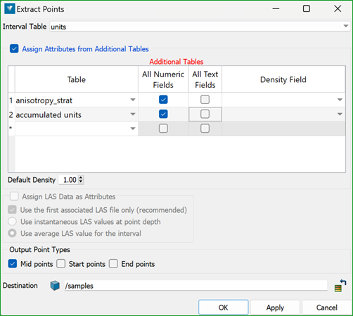
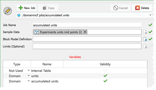
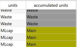
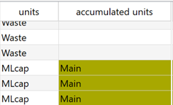
Domain Manager provides rule-based domain definition functionality to prepare additional variables for modelling in DomainMCF. Additional variables are automatically created in a new database field based on accumulation rules of existing variables or grades and/or coding based on surfaces and solids. Multiple additional domain groups and anisotropic guides can be prepared and selected for use when generating the DomainMCF model.
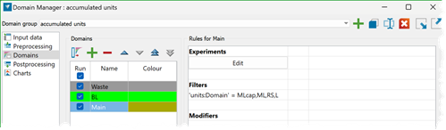
Fig. Domain Manager showing accumulation rules being written into a new “accumulated units” table.
-
Load the domain variable plus guide variables to DomainMCF
Adding a drilling database to a DomainMCF job will trigger the selection of the primary domain variable and additional variables to be modelled. The primary variable defines the intervals used in modelling, and additional attributes are tagged to each interval from any other tables. When additional tables are added, the length intervals of the primary table are used.
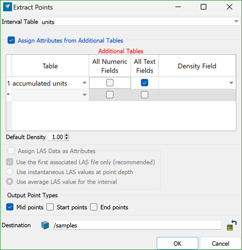
Note: Check that all variables to be modelled are selected correctly as domain or grade variables, as this will influence how the data is used by DomainMCF.
-
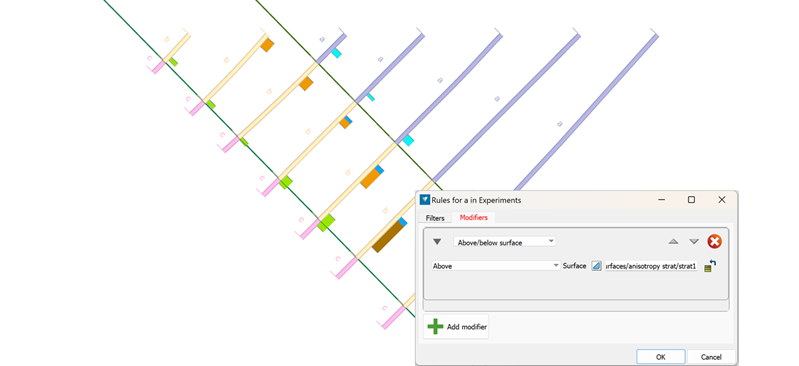
Guide surfaces
Guide surfaces will provide a general geological orientation or spatial trend to the model.
Surfaces that define the structural setting of the model will mimic the geological relationships of the units being modelled. The surfaces are a guide to the model and are not hard domain boundaries. They can easily represent dipping or gently folded structures and may be simple planes or implicit modelled surfaces.
The Domain Manager can code surfaces to generate multiple domains using the domain rule modifiers and above/below surface options.
-
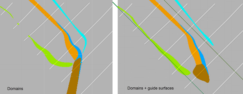
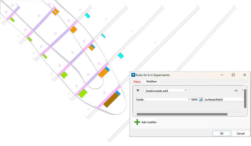
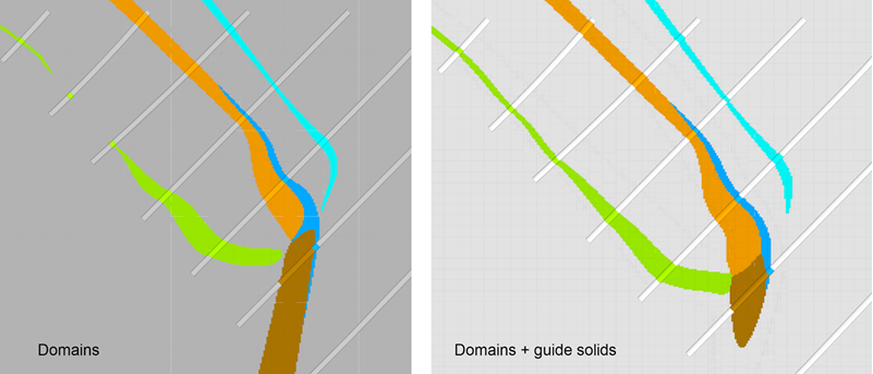
Guide solids
Guide solids provide for more complex orientation control from structural data.
The methods and results for guide solids are the same as guide surfaces, however, solids allow for more complex domains to be generated. Implicit modelling using structural data to generate guide surfaces and solids provides a powerful guide. Consequently, finer domains are modelled accurately within these structural trends.
Coding is done in the Domain Manager using the inside/outside solid modifiers.
-
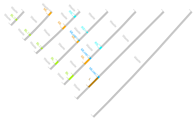
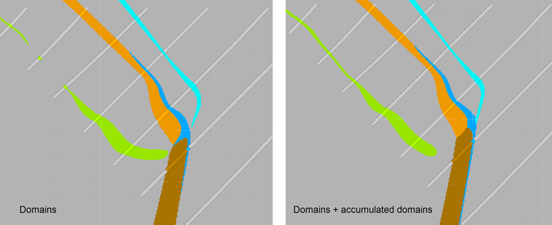
Accumulated domains
Accumulated domains will ensure that specific geological relationships are honoured.
Accumulating domains together into a simplified sequence helps guide the geological relationships. The accumulated domain will be more likely to be continuous at unit boundaries when the entire unit is considered as a whole. This continuity will be carried through to the individual units being modelled.
This is useful to guide parent-daughter relationships or split units in stratigraphic style deposits.
The Domain Manager can accumulate domains from one field into a new accumulated domain table. Use the domain rule filters to select domains, manually or with wildcards, to accumulate units into one or more domains.

-
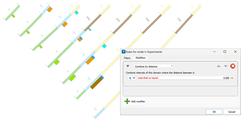
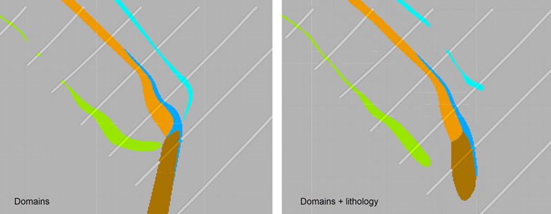
Related variables
Geologically related domains provide more consistent interpretation on shared domain boundaries.
Variables in the drilling database that are related geologically to the main domain being modelled can improve the quality of the model. Weathering or lithology modelled alongside the ore domains will provide guidance, and if geologically related, a more accurate model.
This additional data can be rationalised by the Domain Manager to avoid small internal complexity, using the Combine by distance modifier.
-
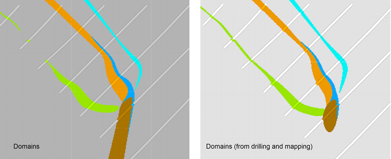
Mapping
Including mapping to guide the model.
Mapping data can be combined with data from drilling to be included in the DomainMCF run. There are a number of important considerations that will increase the influence of the mapping in the model:
-
A grid of points within the mapping polygons will give much greater influence to the model than polygons alone.
-
Including data points on two sides of a domain contact boundary helps define the domain boundaries.
-
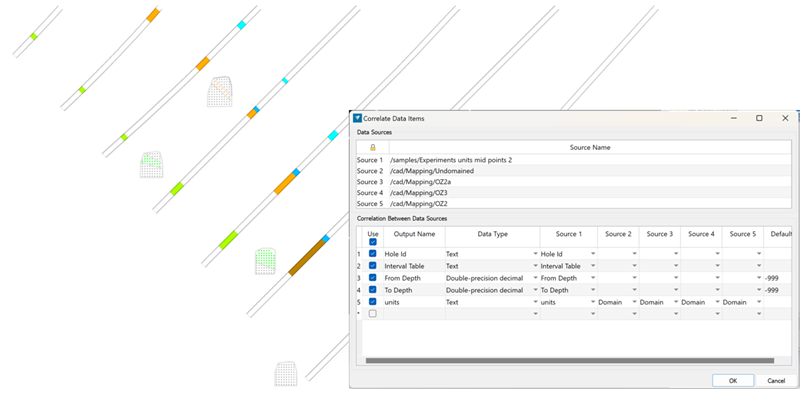
Mapping does not need to be separate domains into unique layers. The domain code needs to be an attribute of the points. This can be coded using the script function if not already defined in the mapping data.
-
Multiple objects can be combined using the Extract (Drillholes to points) and Combine (Drillhole points and mapping) tools. This allows the drilling and mapping to be modelled together in DomainMCF.
-
Data considerations
Data preparation
It is important to consider data preparation when generating any model type. The following table is a guide to the main data preparation, with more information available in Data Preparation.
| Domain distribution | Model resolution | Sample density | Grade |
|---|---|---|---|
| >1% data per domain |
XY - 1/4 drillhole spacing |
4 samples/block (Z) | Remove negative grades |
Fully coded variables
It is also important to ensure that all variables presented to DomainMCF are fully populated when supplying multiple domain or grade fields, as only the fully populated points e.g. points with both a domain and surface trend, will be used in the model.
| Correctly coded | Incorrectly coded | ||
|---|---|---|---|
|
✅
|
❌
|
Multiple supporting variables
Multiple additional variables may be used when generating a geological model. It is important to only use variables that influence the domain, as all supplied variables will be considered when making the domain model.