Registering Reconstruction
Source file: register-photogrammetric-reconstruction.htm
You only need to register a photogrammetric reconstruction if registration from GPS coordinates is unsatisfactory or unavailable. To do so, click on the  Register Reconstruction button on the Photogrammetry ribbon tab, then follow the steps below.
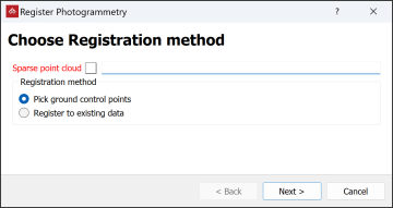
-
Select the required sparse point cloud in the project explorer. It will be automatically added to the Sparse point cloud field.
-
Choose the registration method:
-
Pick ground control points to register to specific survey points.
-
Register to existing data to register to existing scans.
-
-
Click Next >.
-
Expand below according to the chosen method:
 Pick ground control points
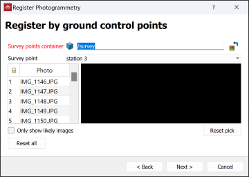
-
Choose an image.
-
Identify a survey point in the project data and drag its container into the Survey points container field.
Note: If there is no a suitable survey point you will need to create one. See Creating Survey Points.
-
If asked to apply a new coordinate system, click Yes.
-
Select the corresponding point on several images.
Tip: Select Only show likely images to filter out images that the software determines don't include the survey point.
-
Repeat for other survey points.
Register to existing data
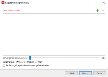
-
Drag suitable registered scans into the Fixed reference data field.
- Select the appropriate Sampling level and Quality of fit. The higher these settings, the more accurate the results will be, but the longer the registration will take.
-
Select Perform rigid registration with non-rigid initialisation to register using settings to help prevent the scale of the result being blown out of proportion at the expense of speed and accuracy.
-
-
Click Next >
-
When the registration has completed, check that the registration is correct in the display.
-
Repeat the registration process as many times as necessary to achieve a satisfactory result, adjusting settings each time.
-
Click Finish.
