Topography
Source file: filter-by-topography.htm
The Topography filter (Ctrl+T) removes unwanted features, such as vegetation, machines and infrastructure, from scans and retain only the relevant topographic surface.
The topography filter divides the scan data into a horizontal grid with a user-defined cell size. Only the single lowest or highest point in each cell is retained to remove unwanted features and reduce the data to a more even point distribution.
-
To filter by topography, follow these steps:
-
Select the scans

 to be filtered.
 -
On the Position and Filter tab, in the Filter group, click
 Topography.
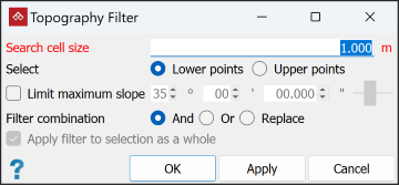
-
Specify a Search cell size and whether to keep Lower points or Upper points.
Note-
The cell size should typically be between
0.5and2m. If the cell size is too large, edges will be excessively rounded. -
Only use Upper points in an underground situation to retain the roof.
-
-
To remove vegetation points, select Limit maximum slope and set an appropriate angle. This will remove any points inside an inverted cone projected upwards from any point.
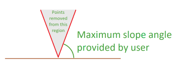
Tip: The default maximum slope is 35°. Try different angles to find the optimum filtering.
-
Select the required Filter combination (see Filter Combinations).
-
Select or clear Apply filter to selection as a whole as required:
-
If selected, the filter treats all selected objects as a single object.
-
If cleared, each selected object is filtered independently.
-
-
Click OK or Apply.
|
|
|
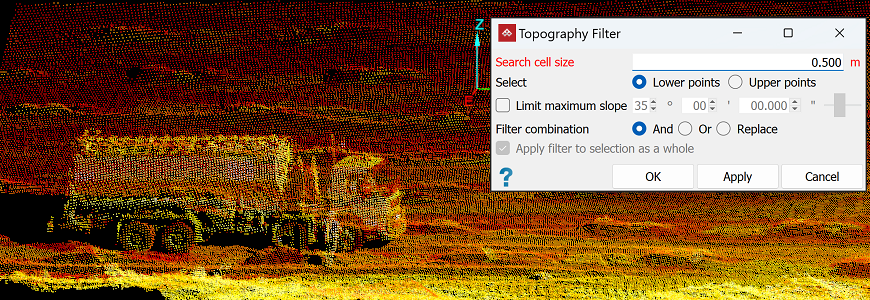
A scan to be filtered (truck to be removed). |
|
|
|
The result of topographic filtering. Any unwanted points remaining must be removed manually. |
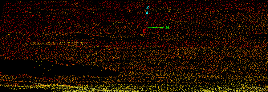
Tip: You can redisplay filtered points
by clicking ![]() Show All. See Show All.
Show All. See Show All.
