Smart Polygon
Source file: create-smart-polygon.htm
Use the smart polygon tool is used to create polygons that track along edges of data, as with the smart line tool (see Smart Line).
The smart polygon tool to behaves differently with different data types. For example:
-
When tracking along triangulations, the line forming the polygon tracks along physical edges in the surface, which is useful when extracting toes and crests.
-
For coloured scan data, the line for smart polygon tracks coloured edges and extracts geological boundaries.
Tip: Colour the scan non-uniformly before creating smart polygons to improve edge selection.
To create a smart polygon, proceed as follows:
-
On the Create ribbon tab, go to the Draw group. From the Polygon drop-down list select
 Smart Polygon.
-
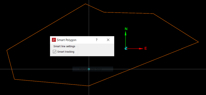
Click on the first point in the view window. Build the polygon by clicking on the next points. Pick points close together to ensure that tracking covers all of the points.
Note: You can also enter point coordinates in the status bar. Click
 to accept each point.

 Tip
Tip-
The smart polygon tool displays a preview of the next smart polygon section before you click to create it. Simply hover the cursor over a point to see where the smart polygon edge would be placed.
-
If the placement of the last edge is unsatisfactory, press Ctrl+Z or click
 to undo, then try another point.
 -
Clear Smart tracking to create a straight edge between the last and next points if the smart edge cannot be placed satisfactorily. Select again to resume smart tracking.
-
-
Right-click or click
 to complete the polygon.
 -
Press Esc or click
 in the status bar to exit the tool.
The polygon is saved in the cad![]() container and displayed in the active view window.
container and displayed in the active view window.
