Connect Sections
Use the Connect Sections option to join cross sections generated by the Apply Sections option, to create a more appealing road design. The sections are joined together by a set of lines. Each line connects similar named points on the road, or on the natural surface section.
- This option is able to connect up to 1, 000 road sections.
- A maximum of 100 points may be connected in a road.
Instructions
On the Iroad menu, point to Edit, and then click Connect Sections.
Select any section. Confirm that the correct layer has been selected. Road sections are stored in a layer named <design_name>.D, natural surface sections in a layer named <design_name>.T.
The sections are joined (Diagram 1). The joining lines for natural surface sections are stored in a layer named <design_name>.P, for road sections in a layer named <design_name>.N.
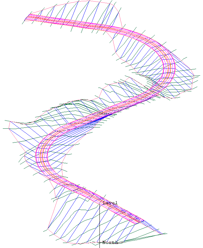
Figure 1: Road Section Lines
Once the sections are joined, you are asked whether or not to create a mask.
A mask is a polygon that totally includes all the created joining lines. The mask is useful when triangulating the road surface so that the triangulation does not extend beyond the roadway. It can also be used by the Design > Object Edit > Delete By Poly option to remove any topography points inside the roadway so that the natural surface can be modelled.
The mask polygon is stored in the layer containing the joining lines (that islayer.N or layer.P). The object name of the polygon is MASK. Diagram 2 shows the mask polygon dragged away for ease of viewing in the documentation.
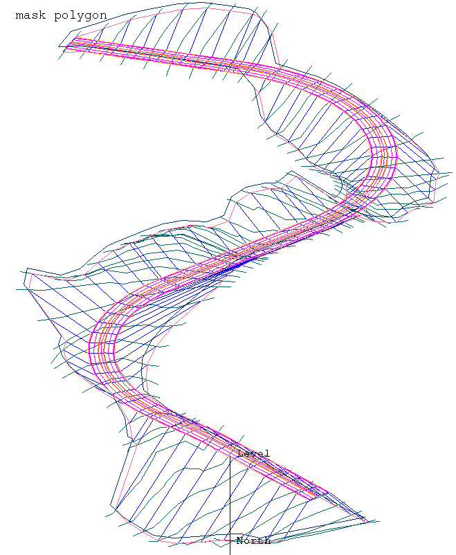
Figure 2: Mask Polygon

