Geostatistical Modelling
Regionalised Variables
A relatively new theory was developed by Professor G Matheron in France during the 1950's that has overcome most of the problems that the statistical and conventional methods are incapable of solving. This method has the general title of "The Theory of Regionalized Variables", that is, variables that are spatially correlated with each other in a geological or other manner (the theory is not restricted to geological variables).
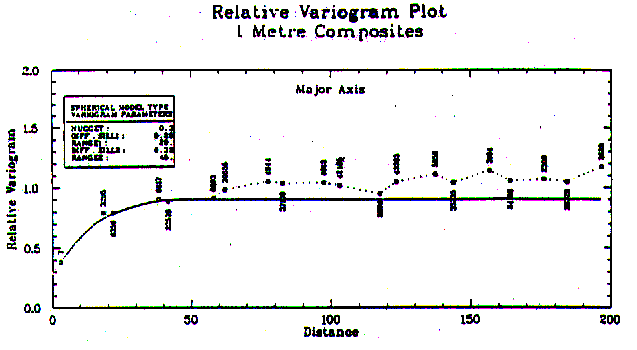
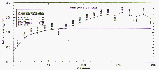
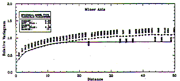
The method accounts for the relationships between the samples that have arisen from common geological processes and captures this spatial correlation in a mathematical expression called the Variogram Function (Fig. 3), which allows an estimation variance or mean squared error to be calculated for any estimate.
The geostatistical method of interpolation of variable values (such as grade) is called kriging after the South African mining engineer DG Krige, who pioneered the theory in South African underground gold mines. This estimator is also known as the Best Linear Unbiased Estimator (BLUE), in which the values of the samples are multiplied by weighting factors that are determined from a set of linear equations.
Figure 3 - Typical Variogram Plots