Overview
The Dragline module is ideal for stratigraphic strip mining operations and provides a suite of tools to deal with range diagrams, reclamation and general section design. Great flexibility is provided in creating very detailed range diagrams. You can effectively simulate the operation of a dragline, cast blasting, bulldozing, truck and shovel operations, and any other kind of material movement, to develop a series of optimised range diagrams.
Support for grids, triangulations, and Vulcan design objects, allows easy development of in situ block layouts. Intersections between cross-section lines, strip plans and horizon surfaces are calculated automatically, to generate the initial range diagram sections quickly and easily. Full control is provided in setting highwall angles and bench offsets.
| Dragline software limits | |
|---|---|
| Maximum number of horizons (both product and waste horizons) that can be accepted by the Dragline module | 100 |
Maximum number of sections per specification file (.rsp) |
50 |
| Maximum number of strips per section | 50 |
| Maximum number of blocks per section | 7500 |
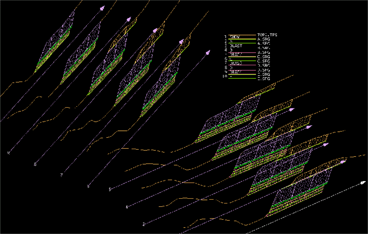
Figure 1: 3D Layout of Range Diagram Cross-sections with Horizon Legend
An exhaustive suite of tools is provided for moving blocks in a wide variety of ways, allowing the user to work in a fully interactive design environment.
Complete, parametric control of all functional dragline dimensions provides a powerful, graphical tool for analysing dragline capabilities and limitations. Average dragline cycles and swing angles are also calculated.
Different swell factors and repose angles can be applied to different material types moved by the different equipment.
Rehandle statistics can be accumulated on each block movement, enabling material to be tracked and monitored through each step of the mining process.
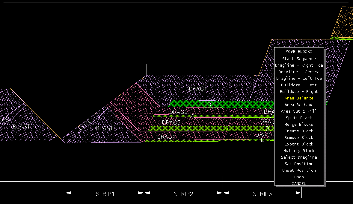
Figure 2: Dragline on Highwall-Side Bench Ready to Make the First Pass with the Area Balance Tool
Multi-coloured operation plots can be generated automatically, showing a series of complicated mining procedures on a single, easy-to-read plot.
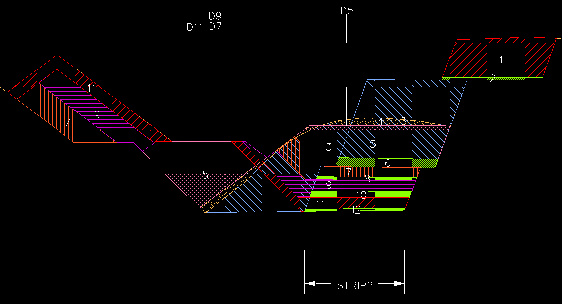
Figure 3: Operation Plot Showing Sequence of Operations Carried Out on a Strip
Formatted reports can be generated on blocks and operations, with totals and weighted averages tallied. Reporting in CSV format enables quick and easy importation into spreadsheet packages, allowing scope for additional analysis and scheduling, if required.
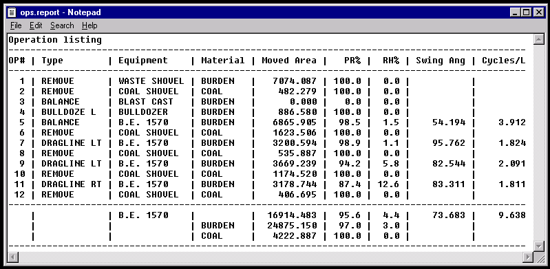
Figure 4: Operation Report Cross-referenced to Operation Plot
Topography strings are updated automatically at every block movement. Strings from different range diagram sections can then be triangulated, to create a series of disturbed surface models.
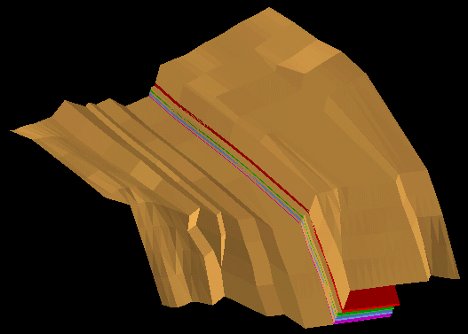
Figure 5: Animation of Topography and Coal Seams

