GDA Conversion
Use this option to transform triangulations using an NTv2 grid shift file.
Australia has used AMG and ISG coordinates, which are based on the Australian Geodetic Datum. However, to align with international spatial coordinate systems, Australia is switching to a system based on the Geodetic Datum of Australia. This coordinate system is called the Map Grid of Australia (MGA).
The GDA Conversion option converts coordinates of selected triangulations from:
Australian Map Grid (AMG) or Integrated Survey Grid (ISG) to Map Grid of Australia (MGA) and vice versa.
Australian National Spheroid (ANS) to Geodetic Datum of Australia (GDA) and vice versa.
The grid file format supported is that supplied by mapping authorities. It is in National Transformation V2 binary grid file format, and is actually a grid file of latitude/longitude shift values. It is possible to use one of the old Australian files, however, we recommend that you download a more current file from the ANZLIC website.
Instructions
On the Model menu, point to Triangle Utility, and then click GDA Conversion. This displays the GDA Conversion panel that contains two tabs namely, Selection and Options.
Selection
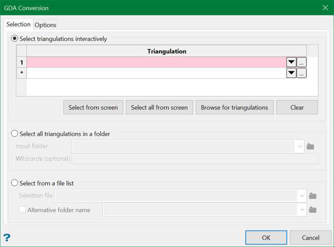
Select triangulations interactively
Use this option to pick up individual or all triangulations from the screen, select the recent ones from the drop-down list, or browse from another directory.
Select all triangulations in a folder
Use this option to select all triangulations residing in a folder. Browse for the folder or choose a recent one from the drop-down list. You can also filter your triangulation selection using the optional Wildcards field by entering the wildcard characters (* and ?) separated by a semi-colon.
Select from a file list
Use this option to select triangulations from a selection (.sel) file. You can also choose an alternative folder where the selection files reside.
Options
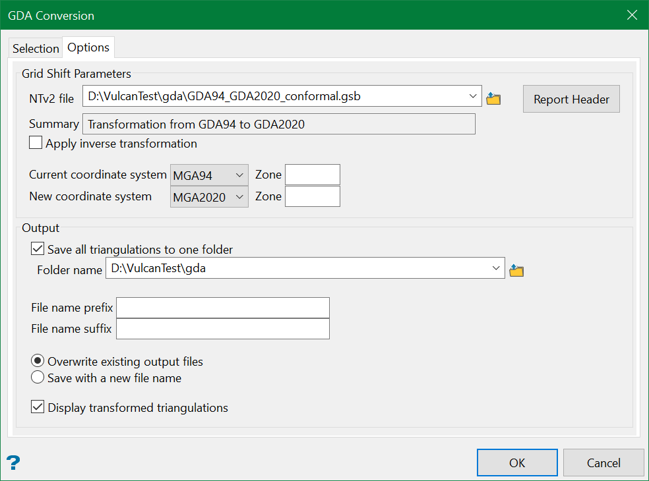
Grid Shift Parameters
NTv2 file
Specify the NTv2 Grid file to use for the conversion. You can choose from the drop-down list if it's in the same directory or browse from a different location.
Report Header
This displays detailed information of the specified NTv2 file in the Report Window, such as number of sub grids, shift type, distortion model, semi-major/minor axes, sub grid name, parent, date of creation, latitude/longitude, and etcetera.
![]()
Summary
This provides a quick insight of the type of conversion being undertaken.
Apply inverse transformation
The NTv2 file contains a shift from one latitude/longitude system to another, normally from an older system to a newer system. Check this box to apply the reverse transformation to that defined in the file.
Current/new coordinate system
Select one of the UTM grid names supported by NTv2 file for the current/new coordinate system grid respectively. Zones are entered as an integer for AMG (between 49-56) and as an integer plus a forward slash and the number 1, 2 or 3 for ISG (between 54/2 - 56/2).
Output
Save all triangulations to one folder
Use this option to save all the transformed triangulations to a single folder. Choose the folder name in the current directory from the drop-down list or browse from another directory. You can also add suffix and prefix to the resultant filenames to distinguish them from the rest.
Overwrite existing output files
Choose this option to overwrite the existing files with the resultant files.
Save with a new filename
You can also choose to save the result in a new file. If the file still exists, it will append a numeric suffix to the filename to create a unique name.
Display transformed triangulations
Select this option to display the transformed triangulations on the screen.

