Import LIDAR Data
The Import LIDAR Data option to load LAS/LIDAR files into layers.
Requirements
To use the features available in this option, you must have either an ASCII file or a LAS file that contains point data to be loaded into Vulcan.
The Load Existing Specification option requires a saved LIDAR specification file that was created when the import functionality was used previously.
Instructions
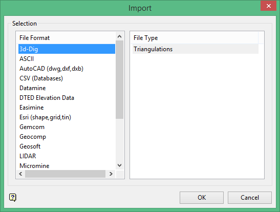
On the File menu, click Import to display the Import panel.
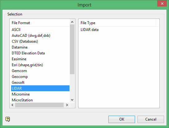
Click LIDAR in the File Format column on the left.
Select LIDAR data from the File Type field on the right side of the panel.
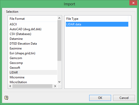
Click OK to display the Load LIDAR Data panel.
Load Existing Specification
Click the Load Existing Specification button in the lower left corner of the panel if you want to use an existing specification that was saved after using the Import option to populate the fields on the panel.
If an invalid specification file was selected when trying to load an existing specification file, a message will display stating that the selected file was not a complete LIDAR specification file. The main panel will then appear with the values set to what they were before the load specification button was clicked.
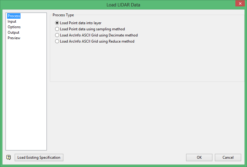
Process Type
Click the Process branch, and then select one of the options in the Process Type section. The Process Type you select will determine the function of the remaining panels in the interface.
Load Point data into layer
Use this option to import point data into a set of Vulcan layers. The data can be found in LAS files, CSV files, DEM files, or your own selection.
Load Point data using sampling method
This option provides a graphical user interface into the executable point_reduce_nn. This is used to resample a large set of point data into a smaller set. This subsequent set of data can be saved as a triangulation, grid, CSV file, or an ASCII file.
Load ArcInfo ASCII Grid using Decimate method
This option provides a graphical user interface into the executable aag_decimate. This is used to resample the provided grid into a smaller set of data. This subsequent set of data can be saved as a triangulation, CSV file, or an ASCII file.
Load ArcInfo ASCII Grid using Reduce method
This option provides a graphical user interface into the executable aag_reduce. Like the decimate method, this is used to resample the provided grid into a smaller set of data. This method is more accurate in the method of resampling the grid data. The subsequent set of data can be saved as a triangulation, grid, CSV file, or an ASCII file.

