Load Fault Zones 
Use Load Fault Zones to load a design database layer containing polygons defining specific areas of interest. Zones represent areas that require independent modelling, such as faults, some qualities and water bodies.
When using zones, you can select a single zone and then model it creating a grid from just the points that fall in that zone, or you can use all zones and Grid Calc will build a grid by modelling each zone independently and connecting the adjoining edges. Zones can also overlap in which case an average value is used as the final result. To model with zones, you need to load the zones and the data (in either order) and then run the modelling as normal.
Each zone must contain at least three data points that define a plane. Grid Calc also supports another style of faulting, involving lines with throw values. These can be used inside a zone, or in situations such as between two close faults, where no actual drillholes have passed.
In the image below, the narrow end of the wedge contained no data, though the wider end did. Trending created realistic models of the fault blocks.
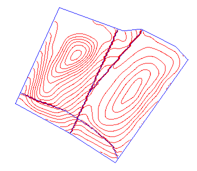
Figure 1: Zones
Instructions
On the Grtid Calc menu, point to Faults, and then click Load Fault Zones to display the Load Zones panel.
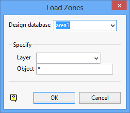
Design Database
Enter, or select from the drop-down list, the name of the design database.
Specify
Layer
Specify the name of the layer. Wildcards (* multiple character and % single character) may be used. The drop-down list displays the names of all the layers found in the nominated design database.
Object
Enter the object (zone) name. Wildcards (* multiple character and % single character) may be used.
Select OK.
The zones are then loaded.

