Define coordinate system
Objects, scans etc. may not have a coordinate system associated with them. When working with various objects, or according to overall requirements of a project, it may be necessary to ensure all objects are oriented and positioned correctly. This function is used to define an initial coordinate system to the selected object. This sets a reference system for coordinate conversions, and is required before a coordinate conversion can be performed. Objects with a coordinate system assigned can be used to flag other objects with the same system.
REFER TO How Do I? > Understanding Coordinate Systems for a background discussion of relevant components and derivations of coordinate systems. This discussion may help in understanding the significance and use of options in the function presented here.
Related commands:
- Manage coordinates in the PointStudio Preferences.
- Convert coordinates.
Define coordinate system
-
Select the required object.
-
On the Position and Filter ribbon tab navigate to the Coordinates group and select
 Define.
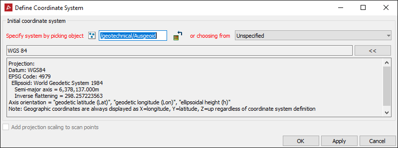
- Specify a coordinate system either by automatically transferring the coordinate system applied to another object, or specifying manually by clicking the specify system button.
To transfer a coordinate system automatically from another object, give focus to the Specify system by picking object field, then either:
- Middle mouse-click and drag the reference object into the field.
- Left-click the reference object in the View window.
Alternatively:
- If you choose to specify a system manually, the Coordinate system panel will open, ready for selecting appropriate attributes.
Add projection scaling to scan points - This checkbox toggles the option to apply projection scaling and distortion as if transforming from a geocentric coordinate system. This should only be used for raw laser scan data.
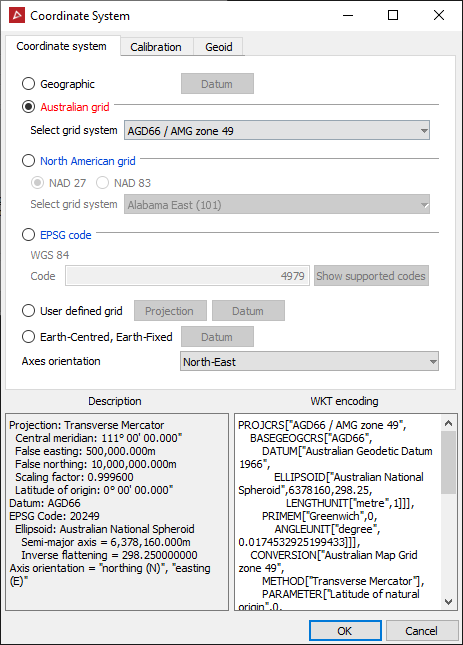
Coordinate system options include:
- Several options based on industry standard setups.
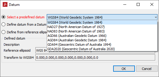
- User defined grid option allowing full flexibility in defining projection, plus Datum including full transformation capability (linear, rotational and scale settings).
- Select the Calibration tab to apply custom offset measurements to horizontal and vertical references.
- Select the Geoid tab to nominate Geoid setting or import a geoid file (*.asc, *.byn, *.ggf, *.gtx).
-
When a system has been initialised, press OK or Apply.