Link Strings
Use Link Strings to link individual line segments, having common points, into single strings thus filtering out the common points. This option is useful for survey data containing underground information imported from other software packages as these packages may have data consisting of line segments with common points.
Instructions
On the Underground menu, point to Development, and then click Link Strings to display the Link Strings panel.
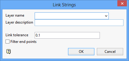
Layer name
Enter, or select from the drop-down list, the name of the layer in which the new strings will be assigned. The maximum size of the layer name is 40 alphanumeric characters (spaces are not allowed).
Layer description
Enter a description to further describe the contents of this layer. The description can be up to 80 alphanumeric characters and may include spaces. If a description is not entered, then a default description will be used instead. If the chosen layer already has an assigned description, the description displays when the layer is selected. Existing layer descriptions can be overwritten.
Link tolerance
Enter the value for the link tolerance, and points that fall in this tolerance will be linked.
Filter end points
Select this check box to omit the end point of the first object from the resulting string. If unchecked, then the end point will be included.
Tip: We recommend that you check this check box when using a small tolerance where the end points for the strings are assumed to be coincident.
Click OK.
The Multiple Selection box is then displayed. This to select the lines by category. Cancel when finished selecting lines. You will then be asked whether or not to link the strings.

