Filter
Source file: filter-group.htm
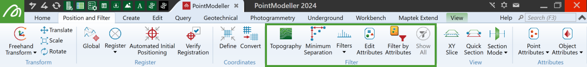
The Filter group tools of the Position and Filter tab enable you to hide or remove unwanted data to working with relevant data simpler. See individual tool topics for more detail.
|
|
Topography (Ctrl+T) Remove unwanted features such as vegetation, machines and infrastructure. |
|
|
Minimum Separation (Ctrl+M) Reduce point density in the near-field while retaining points farther away. |
|
|
Filters Select from several different filtering methods, available from the drop-down menu, according to the situation. |
|
|
Edit Attributes Edit attributes applied to points or objects. |
|
|
Filter by Attributes Filter according to selected attribute values. |
|
|
Show All (Shift+S) Restore filtered data to view. |
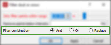
Filter Combinations
Most of the filtering tools allow you to combine previous filter results using the following options:
- And makes a point visible only if the point is visible after applying the most recent filter and the new filter determines the point will be visible.
- Or sets a point visible only if either the point is visible after applying the most recent filter or the new filter determines the point will be visible.
- Replace ignores any point filtering currently applied to the scan. The outcome will be a result of the new filter only.
Note: Filter combinations with ![]() Select by Attribute (see Select by Attribute), will ignore points that aren’t visible.
Select by Attribute (see Select by Attribute), will ignore points that aren’t visible.
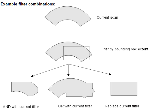
These three options are illustrated below. The scan has been filtered by range (see Filters). This scan is then filtered by a bounding box extent (see Polygon). Shown are the three different regions that result from each of the Filter combination options.
Note: When items in a scan are filtered, they still exist in the database. They can be redisplayed by using the Show All option.
