Define Coordinate System
Objects and scans may not have a coordinate system associated with them. When working with various objects, or according to overall requirements of a project, it may be necessary to ensure all objects are oriented and positioned correctly. This function is used to define an initial coordinate system to the selected object. This sets a reference system for coordinate conversions, and is required before a coordinate conversion can be performed. Objects with a coordinate system assigned can be used to flag other objects with the same system.
Refer to How Do I? > Understanding Coordinate Systems for a background discussion of relevant components and derivations of coordinate systems. This discussion can help in understanding the significance and use of options in the function presented here.
Related commands:
- Manage coordinates in the PointStudio Preferences.
- Convert coordinates.
Define coordinate system
-
Select the required object.
-
On the Position and Filter ribbon tab navigate to the Coordinates group and select
 Define.
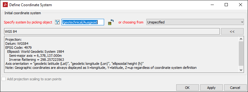
- Specify a coordinate system either by automatically transferring the coordinate system applied to another object, or specifying manually by clicking the specify system button.
- Drag and drop the reference object into the field.
- Click on the reference object in the view window.
-
Alternatively to manually set up a coordinate system to define to select New system... from the or choose from drop-down menu.
Tip: Follow the steps in Manually Setting up a Coordinate System here for further assistance.
-
Add projection scaling to scan points option toggles applying projection scaling and distortion as if transforming from a geocentric coordinate system. This should only be used for raw laser scan data.
-
Click OK or Apply.
To transfer a coordinate system automatically from another object, give focus to the Specify system by picking object field, then either:
OR