Data Source(s)
Use this section of the interface to select the data source(s) that will be used to generate the resulting grid.
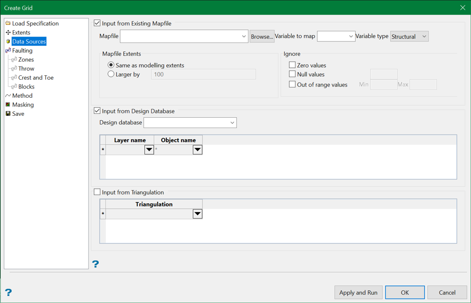
Input from existing map file
Select this check box to use data contained in a selected ASCII formatted mapfile.
Mapfile Extents
The areal extent for the data gathered from the input mapfiles and CAD data are selected by default when a grid modelling range is selected. However, this option enables users to gather data from a wider area for use in calculating a model whilst still limiting the model's extent.
Same as modelling extents
Selecting this option enables user to limit the model's extents by the default value from mapfiles and CAD data.
Larger by
With this option, the model's limit is extended by a value (that is entered here) larger than the default value.
Zero values
Select this check box to ignore zero data values. This option may be used when creating a model (for example, a quality model) where the database contains zero values that do not reflect real measured data.
Null values
Select this check box to ignore null values. Enter a value to be used as the null value. Values matching this in the data source will be ignores.
Out of range values
Select this check box to ignore values that fall outside of a specified range. You will need to specify the minimum and maximum allowable values for the modelling data.
Input from design database
Select this check box to use data from a selected design database.
You will also need to specify the layers and design objects to use. Wildcards (* multi-character and ? single character) are supported.
Input from triangulation
Select this check box to use data from one or more triangulations. The list contains all triangulations in the current working directory. Click Browse to select a file from another location.
Note: If desurvey information is available, it is used by default when generating grid surfaces using this tool.
Related topics

