Output
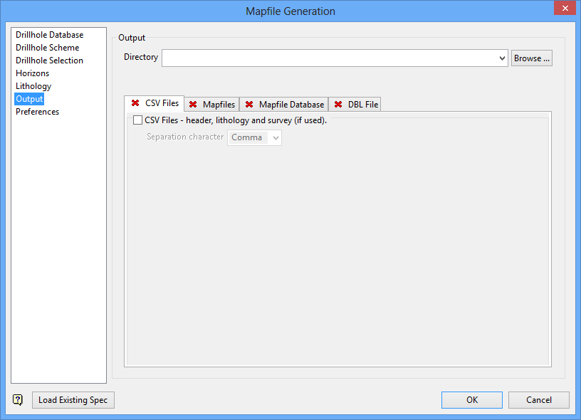
This section of the interface to specify the output for the fixing process.
The following output options may be used in combination, however, at least one of them must be selected.
- CSV Files
- Mapfiles
- Mapfile Database
- DBL File
CSV Files
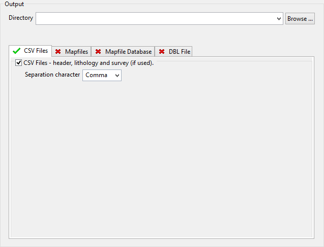
Select this tab box to output the information to some CSV files (.csv). By default, two files will be produced; one containing the header records and the other containing the lithology records.
If downhole survey records have been used, then an additional file will be produced. The depth values reported for the intervals in holes using Downhole Survey Records will be reported with their associated dip and azimuth values. This output is suitable for direct reloading into a database if required.
The resulting files will be named using the following naming convention:
<database name>_header.csv
 <database name>_litho.csv
 <database name>_dsr.csv
where <database name > refers to the name of the database used.
You will be required to specify the character that will be used to separate the values in the resulting CSV files. A comma (,) will be used by default.
Mapfiles
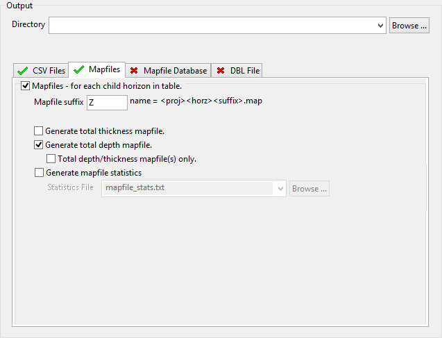
Select this tab to output the information to some mapfiles (.map). A mapfile will be produced for each child seam (lowest level split) in the splits table.
The format of the resulting mapfiles is similar to FIXMAP mapfiles, however, the resulting files contain less whitespace and possess the following fields:
|
FIX_TK |
The interpolated seam thickness at a hole position when not given in the ST/TK columns because the seam it is known to be missing in the hole from the database log. |
|
R_STATUS |
The status of the data given for the roof values. |
|
F_STATUS |
The status of the data given for the floor values. |
|
T_STATUS |
The status of the data given for the thickness value. |
|
P_STATUS |
The status of the data given for the parting value. |
The following status values describe how data is derived and can be one of the following values:
|
DB |
Data derived directly from the logged data in the database without modification, that is, data with good reliability. |
|
DB_FIXED |
Data derived from logged data that required some amount of checking or 'fixing' by this process, for example, data which extends to the top of the hole or above the base of weathering; or data which extends to the bottom of the hole, or data with poor logging reliability when reliability codes are used. |
|
FIXED |
Data derived entirely by interpolation in this process. |
|
MODEL |
Data derived from an external reference control model. |
|
UNKNOWN |
Data item of unknown provenance. This should never be seen, it probably indicates that an error has occurred in the process and should be reported. |
The resulting files will be named using the following naming convention:
<proj><horz><suffix>.map
where <proj> refers to the project code, <horz> refers to the seam and <suffix> refers to the characters used to distinguish the resulting files from normal mapfiles. The default value for the suffix is _Z. This value can be changed, however, it can only contain a maximum of 3 characters.
Generate total thickness mapfile
Select this check box to produce total thickness mapfiles. The resulting files will be named using the following naming convention:
<proj>ttk<suffix>.map
A total thickness mapfile contains the following types of data:
- Drillhole name.
- X/Y coordinate.
- Uppermost horizon name.
- Collar elevation.
- Depth to the top of first horizon.
- Depth to the bottom of last horizon.
- Structural roof value for first horizon.
- Structural floor value for last horizon.
- Thickness of the combined mineable material.
- Zero midburden values.
- Combined parting thicknesses.
- Overburden values.
- Total thickness for all material between the roof of the first horizon and the floor of the last horizon.
Generate total depth mapfile
Select this tab to produce total depth mapfiles. The resulting files will be named using the following naming convention:
<proj>tdp<suffix>.map
Total depth/thickness mapfile(s) only
Select this check box if you only want to produce total thickness and total depth mapfiles without producing the standard mapfiles for all horizons. This check box can only be selected when the Generate total thickness mapfile and/or Generate total depth mapfile check boxes are selected.
Generate mapfile statistics
Select this check box to generate a statistics file along with the mapfile.
Mapfile Database
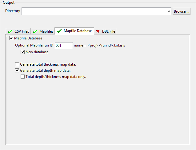
Select this tab to output the information to a mapfile database (.fxd), which is an Isis equivalent to ASCII mapfiles. Mapfile databases provide you with greater security, improved file management, and access to the standard Isis utilities and field calculation functionality.
The resulting files will be named using the following conventions:
<proj><run ID>.fxd
G enerate total thickness mapfile
Select this check box to produce total thickness mapfiles. The resulting files will be named using the following naming convention:
<proj>ttk<suffix>.map
A total thickness mapfile contains the following types of data:
-
- Drillhole name.
- X/Y coordinate.
- Uppermost horizon name.
- Collar elevation.
- Depth to the top of first horizon.
- Depth to the bottom of last horizon.
- Structural roof value for first horizon.
- Structural floor value for last horizon.
- Thickness of the combined mineable material.
- Zero midburden values.
- Combined parting thicknesses.
- Overburden values.
- Total thickness for all material between the roof of the first horizon and the floor of the last horizon.
Generate total depth mapfile
Select this tab to produce total depth mapfiles. The resulting files will be named using the following naming convention:
<proj>tdp<suffix>.map
Total depth/thickness mapfile(s) only
Select this check box if you only want to produce total thickness and total depth mapfiles without producing the standard mapfiles for all horizons. This check box can only be selected when the
DBL File
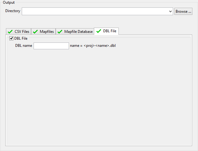
Select this tab to output the information to a Database Listing file (.dbl). The format of the resulting file is similar to the one used by FIXMAP.
Related topics
- Overview
- Drillhole Database
- Drillhole Scheme
- Drillhole Selection
- Horizons
- Lithology
- Output
- Preferences

