Create a Stereonet
The stereonet plots slope and slope direction (dip and strike) of the poles of discontinuities onto a two-dimensional graph. It helps to identify discontinuity sets and analyse the stability of rock slopes.
Data preparation
Before creating a stereonet, suitable data must be prepared.
Note: If this data has previously been prepared and exported to.csv text file, it does not need to be recreated. The stereonet can be created from file data.
-
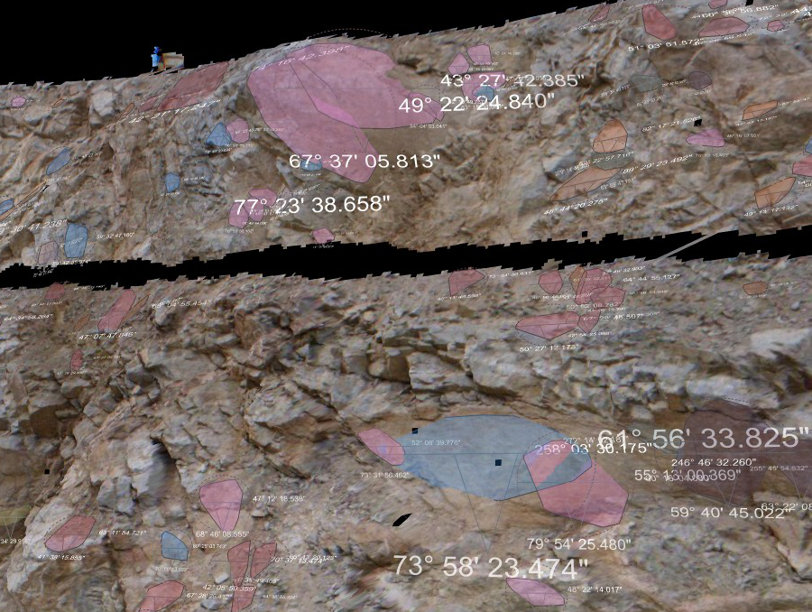
Select a surface created using spherical surface, scan surface or a fusion surface. Topographic surfaces are not suitable for geotechnical analysis as they are created in a top-down manner that does not provide sufficient detail on rock slopes.
-
On the Geotechnical ribbon tab navigate to the Colour group and select
 Colour Dip and
strike to highlight the areas to be analysed.
Colour Dip and
strike to highlight the areas to be analysed. -
Select point or facet selection mode.
-
Select some points on a structure of interest.
-
On the Geotechnical ribbon tab navigate to the Stereonet group and select
 Extract
discontinuities.
Extract
discontinuities. -
Repeat this process (steps 2 - 5) for all structures of interest. Discontinuity objects are saved in the geotechnical container for each query.
Stereonet creation
-
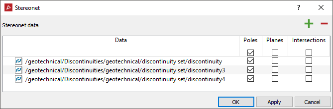
On the Geotechnical ribbon tab navigate to the Stereonet group and select
 Create Stereonet.
 -
Transfer discontinuity data to the Data field.
-
Select poles, planes or intersections.
-
Click OK or Apply to create a new stereonet in the geotechnical container.
Stereonet view options
-
Open the new stereonet in a view window. The stereonet toolbar will be displayed. Use the options available to set up the stereonet.
Stereonet
toolbar 
-
Select the Stereonet type by toggling between :
![]() Equal Area
(Schmidt) or
Equal Area
(Schmidt) or ![]() Equal Angle (Wulff)
Equal Angle (Wulff)
- Equal area (Schmidt): A map projection on which a constant ratio of areas is preserved, so that any given part of the map has the same relation to the area on the sphere it represents as the whole map has to the entire area represented.
- Equal angle (Wulff): A map projection on which a constant ratio of angle is preserved.
-
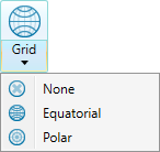
Select the Grid Style:
-
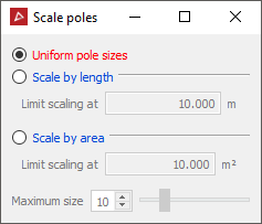
If you want the poles to be sized according to their discontinuity or triangle area select Scale poles
 .
.
The stereonet is saved in the geotechnical container.
Stereonet examples:
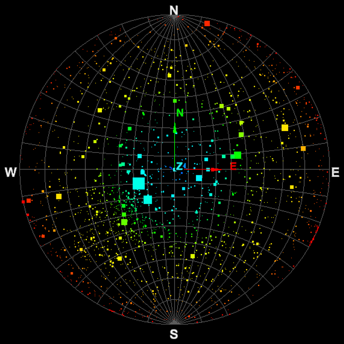
Stereonet - equal angle, Equatorial grid, Scale poles by area.
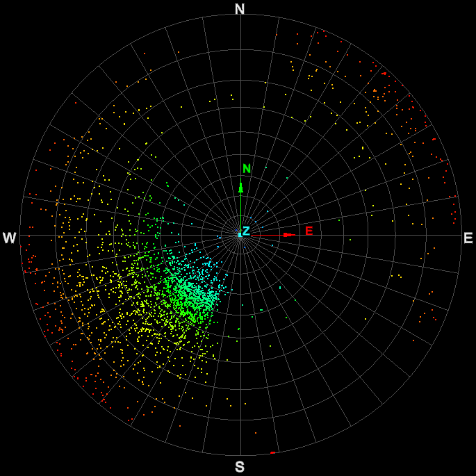
Stereonet - equal angle, Polar grid.
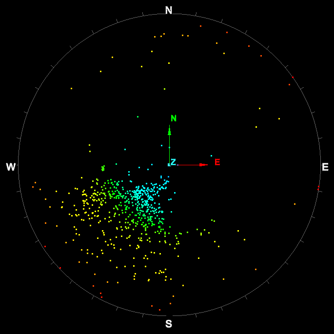
Stereonet - equal angle, no grid.
Note: The stereonet data can have contours added to help identify data of interest.