Fault Zones
Options in the Fault Zones subpanel include information about faulting in the drillholes in the interpolation process. There are two ways to define faults.
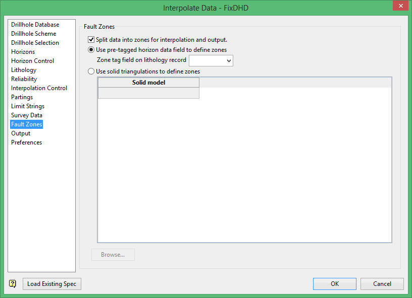
Use pre tagged horizon data field to define zones
This requires that a field in the geology table of the database has been populated with a fault zone tag. In the excerpt from the drillhole database below, the value of the FAULT field changes from flt2 to flt6, this represents the fact that this hole is intersected by a fault.
Note: Geology > Drilling > Flag will quickly flag database fields with values.
The flagging resolution is only as good as the initial logging of the database. Flagging does not insert new records into the drilling database.
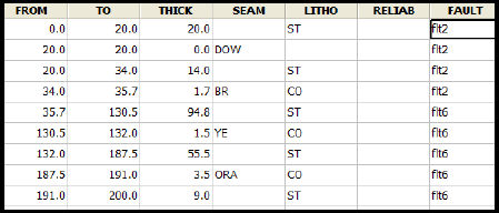
Figure 1: Database flagged with fault data:
Use solid triangulations to define zones
Fault zone domains are represented by mutually exclusive, valid, triangulated solids. Using this method, there is no requirement for any faulting data to be held in the drilling database, so fault definition is not restricted to existing drillhole intervals.
As shown in the figure below, triangulations do not have to respect drillhole intervals.
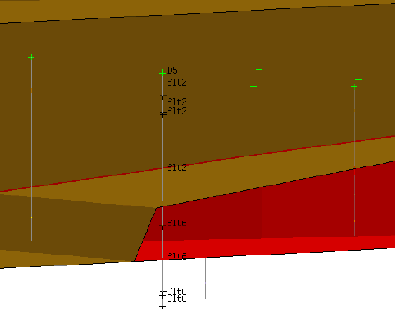
In the cross-section above, the drillhole used as the flagged example displays with a red, fault triangulation. Note that the location of the triangulated fault interface lies in a logged interval. In this example, the fault is represented more accurately by the fault solid than it would be using the flagging method.
Regardless of the method used to define faults, FixDHD will ‘break’ affected drillholes into two or more faulted drillholes for interpolation purposes. This reduces errors due to fault-induced thickening or thinning of intervals when interpolating and modelling.
This option will result in Mapfiles or Mapbases for every horizon in each fault block.
Note: If used, survey dummy holes cannot be assigned to a zone's output when the zones are defined by DB-tags rather than triangulations.
Use this section to incorporate faults into the horizon interpolation process. The faults can be input as triangulation solids or as a pre-populated flag field in the lithological table that changes, for example, from 'FLTA' to 'FLTB', as the hole crosses the location of the fault. The flag field can be created through using the Flag option (under the Geology > Drilling submenu).
Any borehole that straddles the fault zone(s) will be broken up into a number of temporary boreholes for interpolation. The total number of temporary boreholes will equal the number of faults that intersect the hole plus one.
Related topics
- Overview
- Drillhole Database
- Drillhole Scheme
- Drillhole Selection
- Horizons
- Horizon Control
- Lithology
- Reliability
- Interpolation Control
- Partings
- Limit Strings
- Survey Data
- Fault Zones
- Output
- Preferences

