Intersection Report
This section allows users to assess the downhole depths that a drillhole is expected to intersect with ore domains (or other geological domains) triangulations and generate a CSV report. This allows both drillers and logging geologists to quickly know areas of interest and when to expect certain types of geology. This can also be particularly useful when expecting to drill through hazardous materials.
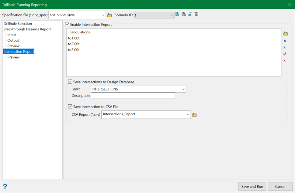
Enable Intersection Report
Selecting this option will run the Intersection Report when Save and Run option is clicked.
Triangulations
Select the desired triangulations, such as expected geological domain solids, to test for intersections with the planned drillholes. Triangulation can be selected by either browsing, selecting existing triangulations on the screen using the Screen Pick, or Select all triangulations from screen options from the controls on the right.
Save Intersections to Design Database
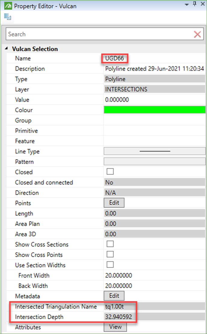
Selecting this option saves the intersections as points into a layer in the currently open design database. A layer name must be provided and an optional description may be added if required.
The objects (points) created will be named according to the drillhole name. The name of the intersection triangulation and the downhole depth of the intersection get stored in metadata attributes.
Save Intersections to CSV File
Selecting this option saves the intersections into a CSV file, with the name of the triangulation intersected, the coordinates of the intersection points, and the downhole depth of the intersection.
Related Topics
- Evaluate Drill Density
- Create Drill Targets
- Create Drillholes
- Edit Drillholes
- Reporting
- Deviation Calculation Manager
- Drill Rig Setup Specification
- Cost Estimation Specification
- Reposition Hole
- Convert Object to Drillhole

