Terminology
Some of the terminology used in the Iroad documentation is specific to road design, and used in a particular context. These terms are listed below.Terrain
The terrain forms the basis of the surface on which the road is designed. In the Iroad module, the terrain is a triangulated surface, which must be present for the design to proceed. The terrain may be generated from a number of sources, such as the digitising of maps, surveying of landscape or photogrammetry.
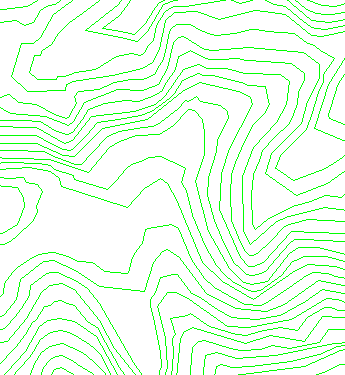
Figure 1: Set of Typical Terrain Strings
IP
I Ps or intersection points form the basis for creating the road alignment. They are a set of control points that define the path that the alignment will take. These IPs may either be horizontal, to generate the horizontal alignment, or vertical, to generate the vertical grade. In the Iroad module, the horizontal IPs have associated with them the radius of curvature of the alignment near that point, while the vertical IPs have the length of the parabolic arc near that point.
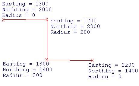
Figure 2: Set of Horizontal IPs
Alignment
The alignment is the curve that is created on the basis of the IPs. It is the line that the road follows, this line is not necessarily the centre line. In the Iroad module it is a line in 3D space consisting of points with the easting, northing, elevation and chainage value of the points.
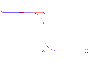
Figure 3: Set of IPs with Alignment Fitted
Chainage
When the alignment is created, the points on it are given chainage values. Each point on the alignment is given a value that is a linear distance along the curve, from a given starting point.

Figure 4: Chainage Points along the Alignment
Long Section
In the Iroad module, the long section is the view along the alignment. In conventional X, Y co-ordinates this is seen as increasing chainage along the X-axis, and elevation along the Y-axis. This view is used for looking at the terrain under a horizontal alignment, and for designing the vertical IPs and vertical alignment.
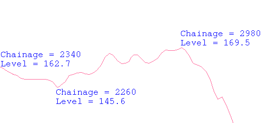
Figure 5: Natural Surface Long Section
Cross section
The cross section is the vertical section through the roadway perpendicular to the direction of the alignment. This view is used for looking at the road cross section and modifying it.
Batters
The batters are the sloping sides of the cross section that come about when the road section cuts into the terrain, or when the road is above the terrain and fill is needed. In the Iroad module, the batters can be specified as either normal or catch line type.
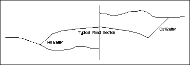
Figure 6: Typical Iroad Section against Terrain with Cut and Fill Batters
Super elevation
Super elevation is the amount of camber or sideways inclination that the road surface undergoes when passing around horizontal curves. The super elevation is applied independently to each side of the road usually determined by a super elevation diagram.
Related topics:
- Overview
- Data Structure
- Quick Reference
